


Chapter-wise Class 6 Social Science The Earth Our Habitat Questions and Answers Free PDF Download
The NCERT Geography Class 6 Solutions offers clear and detailed answers to all the questions in the textbook. These solutions help students straightforwardly understand important geographical concepts. The Earth Our Habitat is a crucial part of this subject. This book helps to understand the wonders of our planet. It covers various topics, including the Earth's formation, landforms, water bodies, and climatic conditions, providing a comprehensive overview of our natural environment.
 Table of Content
NCERT Solutions For Class 6 Social Science is also great for exam preparation, covering all key topics and questions from the textbook. By using CBSE Class 6 Social Science Syllabus, students can clear up any doubts, reinforce their understanding, and build a strong base in Geography. This resource is designed to improve performance, making it essential for Class 6 students.
NCERT Solutions for Class 6 Geography Chapter-wise Links - Download the FREE PDF
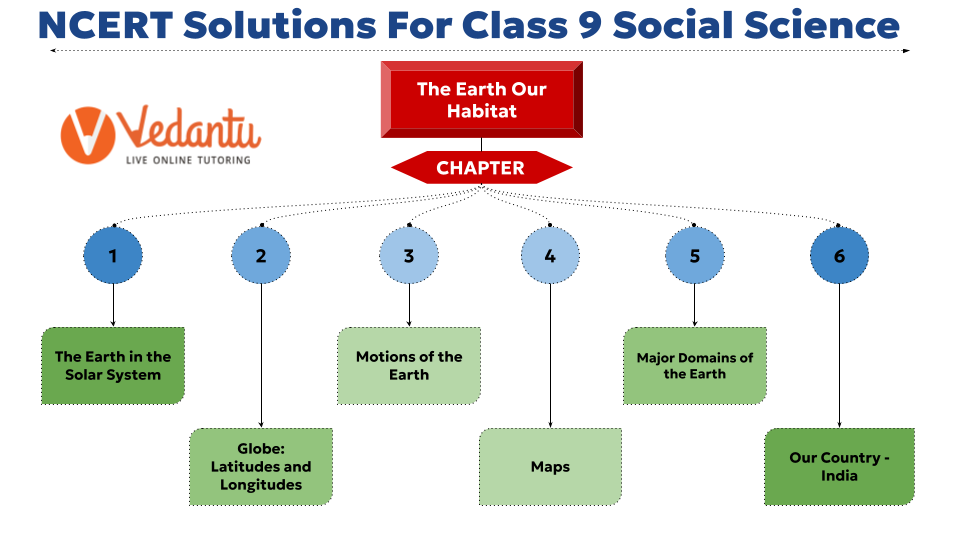
Below is the pictorial representation of the Class 6 NCERT Geography Syllabus for better understanding.
Quick Overview of NCERT Solutions Class 6 Geography
NCERT Geography Class 6 provides answers to all chapters in the NCERT textbook, ensuring complete coverage.
NCERT Class 6 Geography solutions help students practise and evaluate their understanding of Geography concepts, aiding in better retention and clarity.
In the Geography NCERT Class 6, Each solution offers detailed explanations, including step-by-step methods and relevant examples, facilitating effective learning and revision.
This resource is essential for exam preparation, helping students build a strong foundation in Geography NCERT Class 6 and their confidence in tackling exam questions.

FAQs on NCERT Solutions For Class 6 Social Science The Earth Our Habitat - 2025-26
1. How do the NCERT Solutions for Class 6 Social Science Chapter 2 explain the true shape of the Earth?
The NCERT Solutions for Chapter 2 clarify that the Earth is not a perfect sphere. It is slightly flattened at the North and South Poles and has a bulge in the middle. This unique shape is called a geoid. The solutions use this concept to explain why a globe is considered a true miniature model of our planet.
2. What is the step-by-step method to define the Equator as per the NCERT solutions?
According to the NCERT Solutions for the 2025-26 syllabus, the Equator is explained in the following steps:
- It is an imaginary circular line that runs horizontally on the globe, dividing it into two equal halves.
- These two halves are known as the Northern Hemisphere and the Southern Hemisphere.
- The Equator represents the 0° latitude and acts as the main reference point for measuring the location of other places to the north or south.
3. How do the NCERT Solutions for Class 6 Geography Chapter 2 help differentiate between latitudes and longitudes?
The solutions provide a clear distinction between these two concepts:
- Parallels of Latitude: These are all imaginary circles parallel to the Equator. They measure the distance north or south of the Equator and are unequal in length, shrinking towards the poles.
- Meridians of Longitude: These are imaginary semi-circles that run from the North Pole to the South Pole. They measure the distance east or west of the Prime Meridian and are all equal in length.
4. How can I use the NCERT solutions to solve the question, 'What are the three heat zones of the Earth?'
The solutions provide a structured answer by describing the three main heat zones based on the heat received from the sun:
- The Torrid Zone: Located between the Tropic of Cancer and the Tropic of Capricorn, this zone receives the most direct sun rays and is the hottest.
- The Temperate Zones: These lie between the Tropic of Cancer and the Arctic Circle in the north, and the Tropic of Capricorn and the Antarctic Circle in the south. They experience moderate temperatures.
- The Frigid Zones: These are located beyond the Arctic and Antarctic Circles. They are very cold because the sun's rays are always slanting.
5. What is the correct method to explain India's Standard Time (IST) using concepts from Chapter 2?
Following the methodology in the NCERT solutions, you would explain that India uses the longitude of 82°30' E as its Standard Meridian. The local time at this meridian, which passes through Mirzapur in Uttar Pradesh, is taken as the standard time for the entire country. This is known as the Indian Standard Time (IST) and helps maintain uniform time nationwide.
6. Why is it necessary to have a standard time for a country with a large east-west extent like India?
The concepts in Chapter 2 help explain that India's wide longitudinal extent (about 29 degrees) causes a significant time difference of nearly 1 hour and 45 minutes between its easternmost point in Arunachal Pradesh and its westernmost point in Gujarat. To prevent confusion in transport schedules (like trains and flights) and daily administration, a single standard time is adopted for the whole country based on a central meridian.
7. Why do the NCERT solutions describe meridians of longitude as 'semi-circles' but parallels of latitude as 'circles'?
This distinction is crucial. Parallels of latitude are complete, horizontal circles that run parallel to the Equator and never meet. In contrast, meridians of longitude are lines that converge at the North and South Poles. Each meridian runs from one pole to the other, forming only a semi-circle. A full circle is only formed when a meridian is paired with its opposite meridian (e.g., the 0° Prime Meridian and the 180° meridian together).
8. According to the principles in Chapter 2, why does the Torrid Zone receive the maximum amount of heat?
The NCERT solutions explain that the Torrid Zone, situated between the Tropic of Cancer and the Tropic of Capricorn, receives the maximum heat because the midday sun is exactly overhead at least once a year in this region. This vertical angle of the sun's rays concentrates the heat in a smaller area, making it the hottest zone on Earth, unlike other zones where the sun's rays are always slanting.
9. How does knowing the longitude of a place help in calculating its local time?
The solutions for this chapter establish a direct relationship between longitude and time. The Earth rotates 360° in 24 hours. This means it covers 15° of longitude in one hour, or 1° in four minutes. By knowing a place's longitude relative to the Prime Meridian (0°), one can calculate its time. For every 15° east of Greenwich, the local time is one hour ahead, and for every 15° west, it is one hour behind.
10. Why is it impossible to locate a specific point on a globe using only its latitude?
The NCERT solutions help us understand that a parallel of latitude (e.g., 20° N) is a complete circle that passes through numerous locations across different continents. Using only latitude tells you how far north or south you are, but not your east-west position on that line. Therefore, a meridian of longitude is also required. The intersection of a specific latitude and a specific longitude provides the precise coordinates needed to pinpoint any exact location on the globe.